HARBETSUVAN
Over the Hills
HARBETSUVAN
Location
Harbetsuvan Tepesi is located approximately 45 km southeast of Şanlıurfa in southeastern Turkey (Fig. 1). The mound, ca. 95 m × 80 m (0.6 ha) with an altitude of 740 m asl., was found to have perched on top of the Lower Miocene limestone hills of the Tektek mountain, overlooking the Harran Plain to the west (Fig. 2). Standing on the site, one can command a good view of Göbeklitepe to the northwest at a distance of 35 km as the crow flies, as well as another large Neolithic settlement of Karahantepe approximately 7 km to the northeast. This intervisibility linking these important mound sites may suggest a useful viewpoint in interpreting the role of Harbetsuvan Tepesi in the Neolithic landscape and ideological life.
Research History
In 2014, it was identified as a Neolithic site by the Şanlıurfa Museum’s archaeological survey. Between 2017 and 2019, three seasons of excavations were then conducted under the direction of Bahattin Çelik, Iğdır University, mainly to document the archaeological remains in the looted areas. The excavations revealed a series of Pre-Potttery Neolithic (PPN) stone structures and artifactual remains. The stone structures, partially destroyed by looting, consisted of rectangular buildings, at least one of which was equipped with a pair of stone pillars at the center. Stone construction included an important finding: a seated male sculpture resembling those recovered at Göbeklitepe and Karahantepe. The associated artifacts represented an Early PPNB assemblage, consisting of flint and obsidian artifacts, ground stones, incised stone objects, and stone beads whose parallels are found in the upper levels of Göbeklitepe. These results led the excavators to suggest that Harbetsuvan Tepesi served as a small-scale PPNB cultic center.
Sayburc-1
Sayburc-2
Sayburc-3
Sayburc-4
Sayburc-5
Sayburc-6
Sayburc-7
Sayburc-8
Sayburc-9
Sayburc-10
Sayburc-1Sayburc-2Sayburc-3Sayburc-4Sayburc-5Sayburc-6Sayburc-7Sayburc-8Sayburc-9Sayburc-10
Fig. 3:Harbetsuvan Tepesi before the renewed excavations, looking west (Photo in 2022). The stone piles indicate the previous excavation squares were refilled with uncovered limestone boulders.
New project since 2022
The Neolithic transformation in Anatolia, starting some 12,000 years ago or earlier, saw fundamental changes not only in prehistoric human lifestyle but also brought about co-evolutionary shifts in much broader human-environment systems in which human activities began to have greater and irreversible impacts on the Earth system. This period has been referred to as one of the most crucial turning points in human history. The new project organized in 2022 aims to clarify the nature of the Neolithization processes from both humanity and geoscience perspectives.
Fig. 4: Geomagnetic prospection on the mound.
Despite large-scale excavations and multifarious studies in recent decades at Göbeklitepe and most recently at Karahantepe, we have not been able to provide a chronological narrative of human-nature interactions in the Neolithization processes. A major reason for this situation in the Urfa region seems to be the insufficient availability of chronologically controlled data for this argument. The aforementioned mega-sites certainly provide excellent opportunities to investigate the Neolithization chronologically. However, their complex stratigraphic contexts, owing to large-scale construction activities that were intensively repeated over centuries and more, always provide a caution to the possibility of stratigraphic mixing of the recovered findings.
Fig. 5 Ground-penetrating radar (GPR) prospection on the mound.

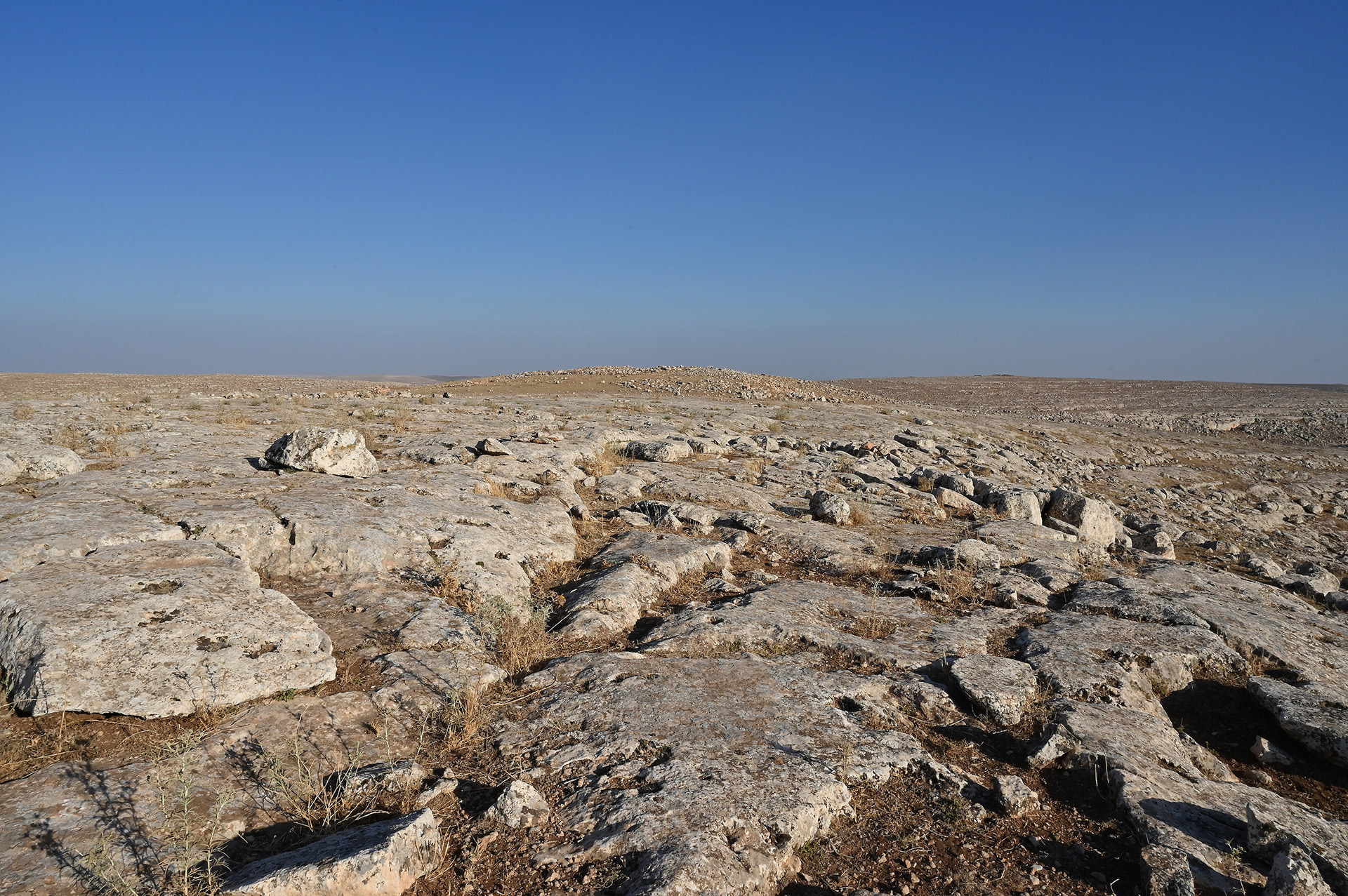
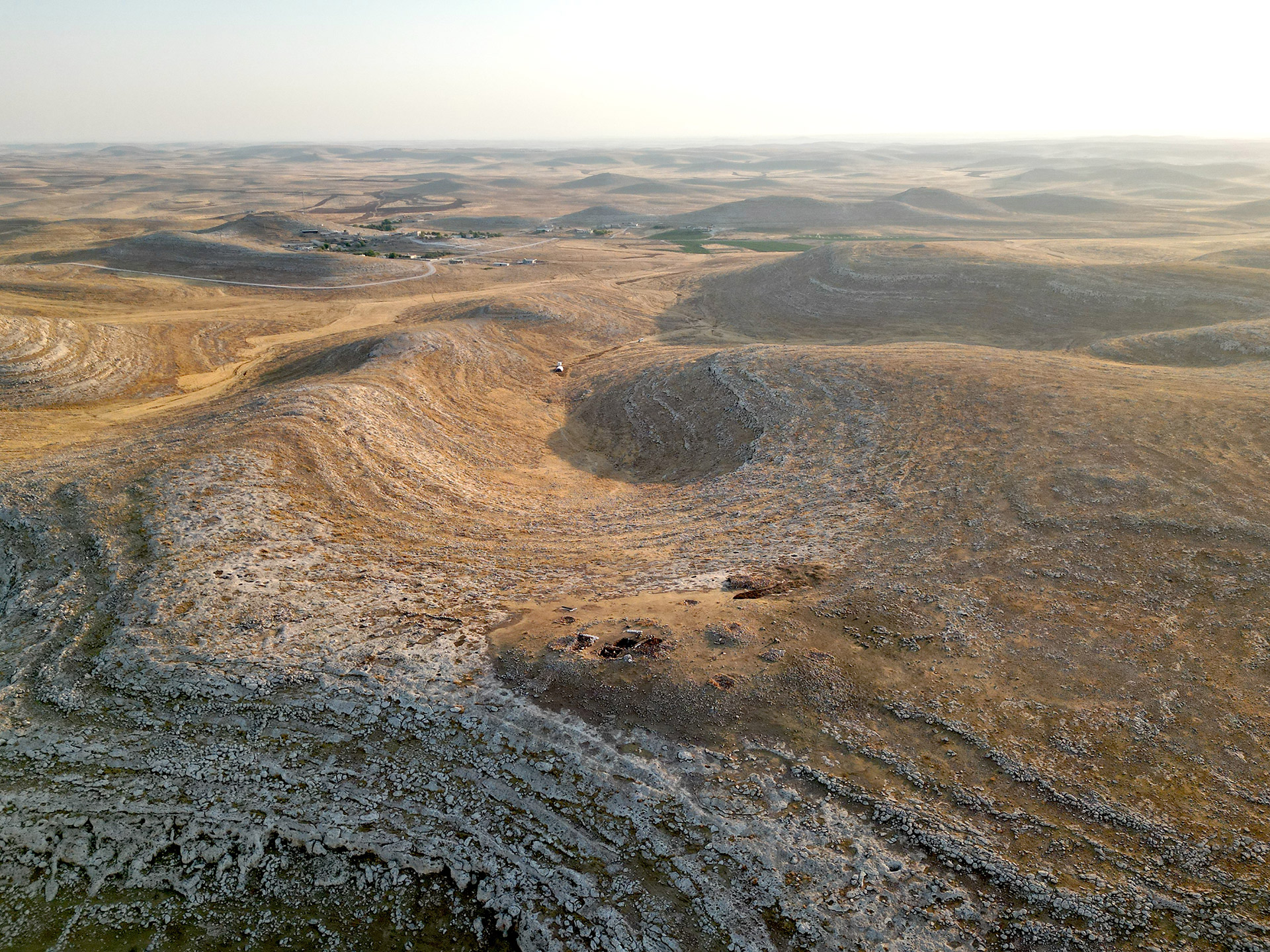
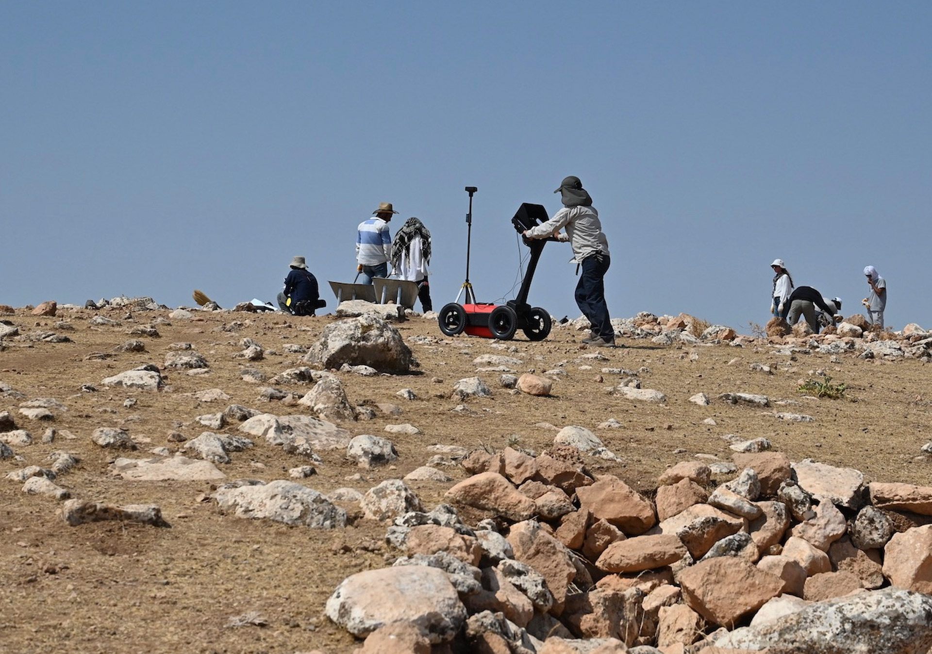
In this regard, research at a short-period site, therefore, lesser risk of stratigraphic mixing of the archaeological records, must produce a chronologically controlled view of a stage of Neolithization, albeit on a limited scale. Consequently, we resumed excavations in 2022 at Harbetsuvan Tepesi to define a facet of the human-nature interactions in the EPPNB in Southeast Anatolia (Fig. 3). Our project is characterized by the employment of cutting-edge geophysical research strategies as well as solid archaeological fieldwork and analyses. We aim for the results to be interpreted in a framework developed through our own research in the neighboring regions.

Fig. 6: Removing backfills of the previous trenches.
Geophysical research
Preliminary geophysical investigations using geomagnetic (Fig. 4) and ground-penetrating radar prospections (Fig. 5) suggest that the mound was formed by artificial deposits mainly of limestone boulders and sediments, not more than 3 m in thickness. Furthermore, they detected numerous rectangular structures buried across the mound. Interestingly, our geomagnetic survey also detected a large round feature, perhaps encircling the entire mound (wall or ditch?).
Archaeological Results

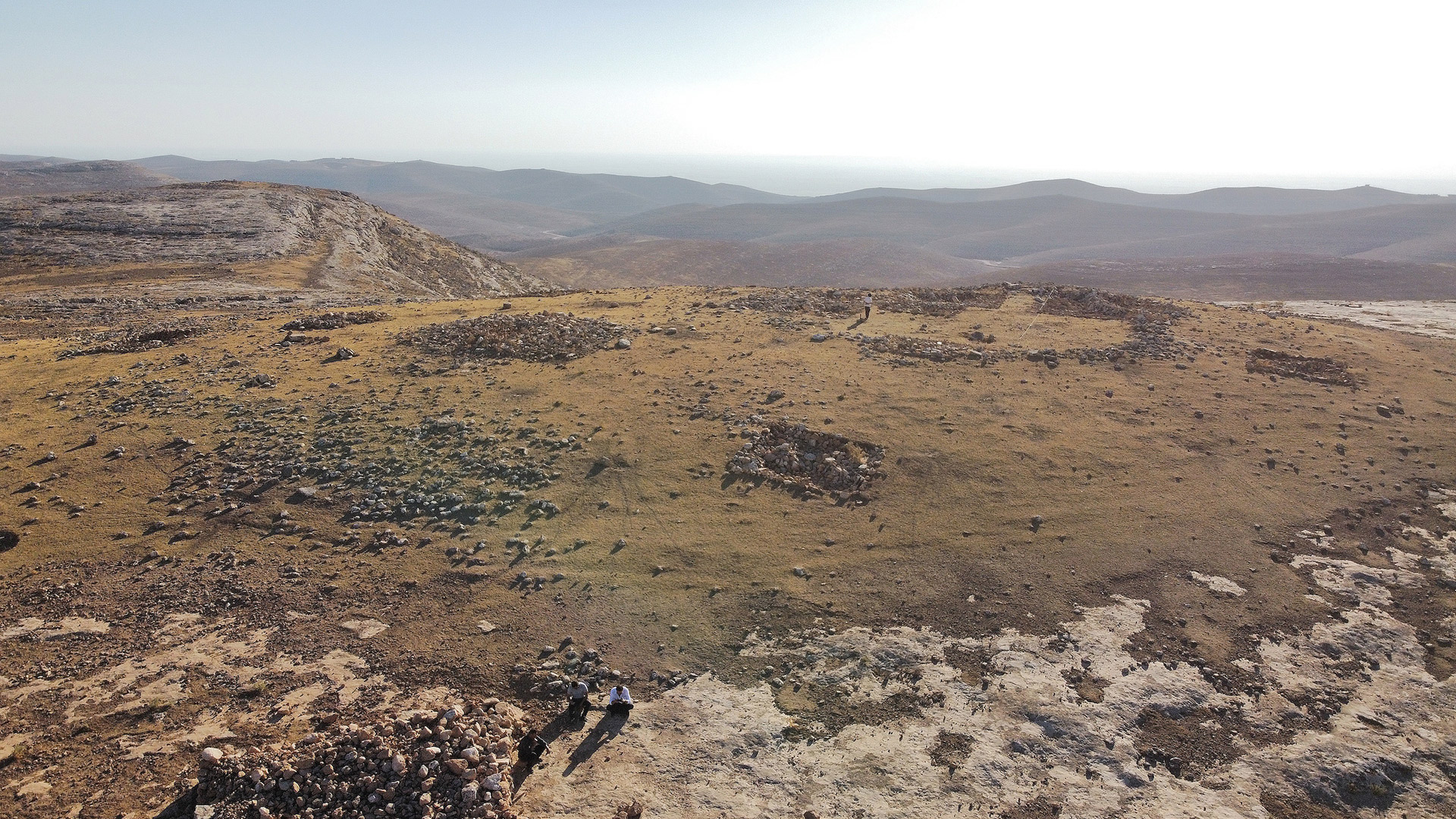
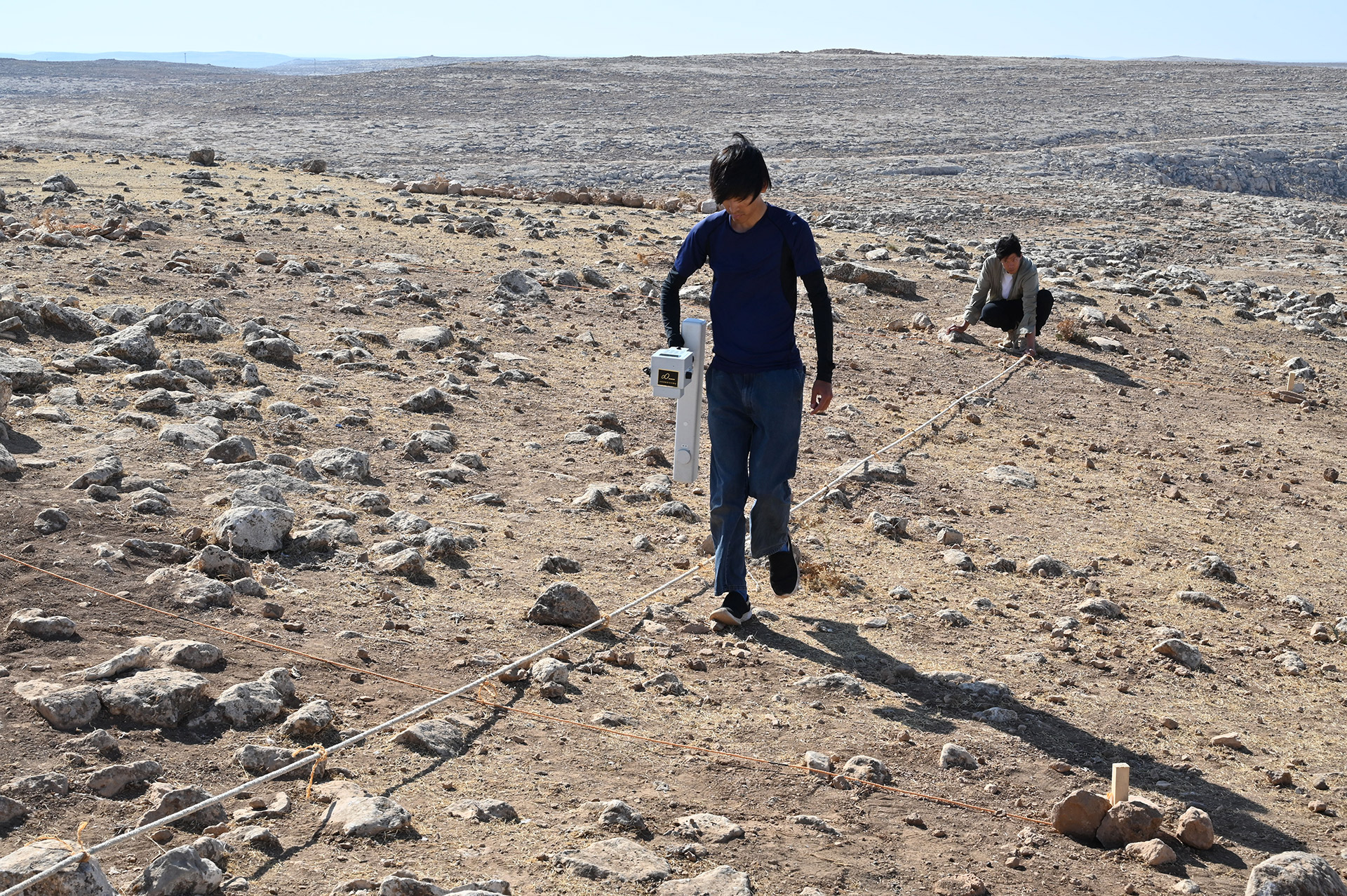
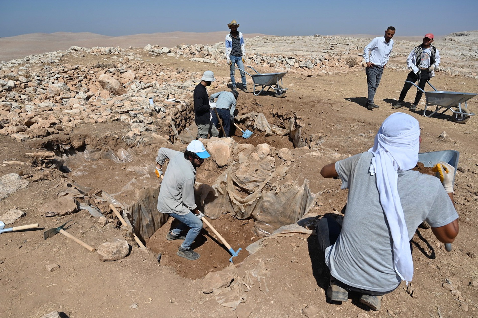
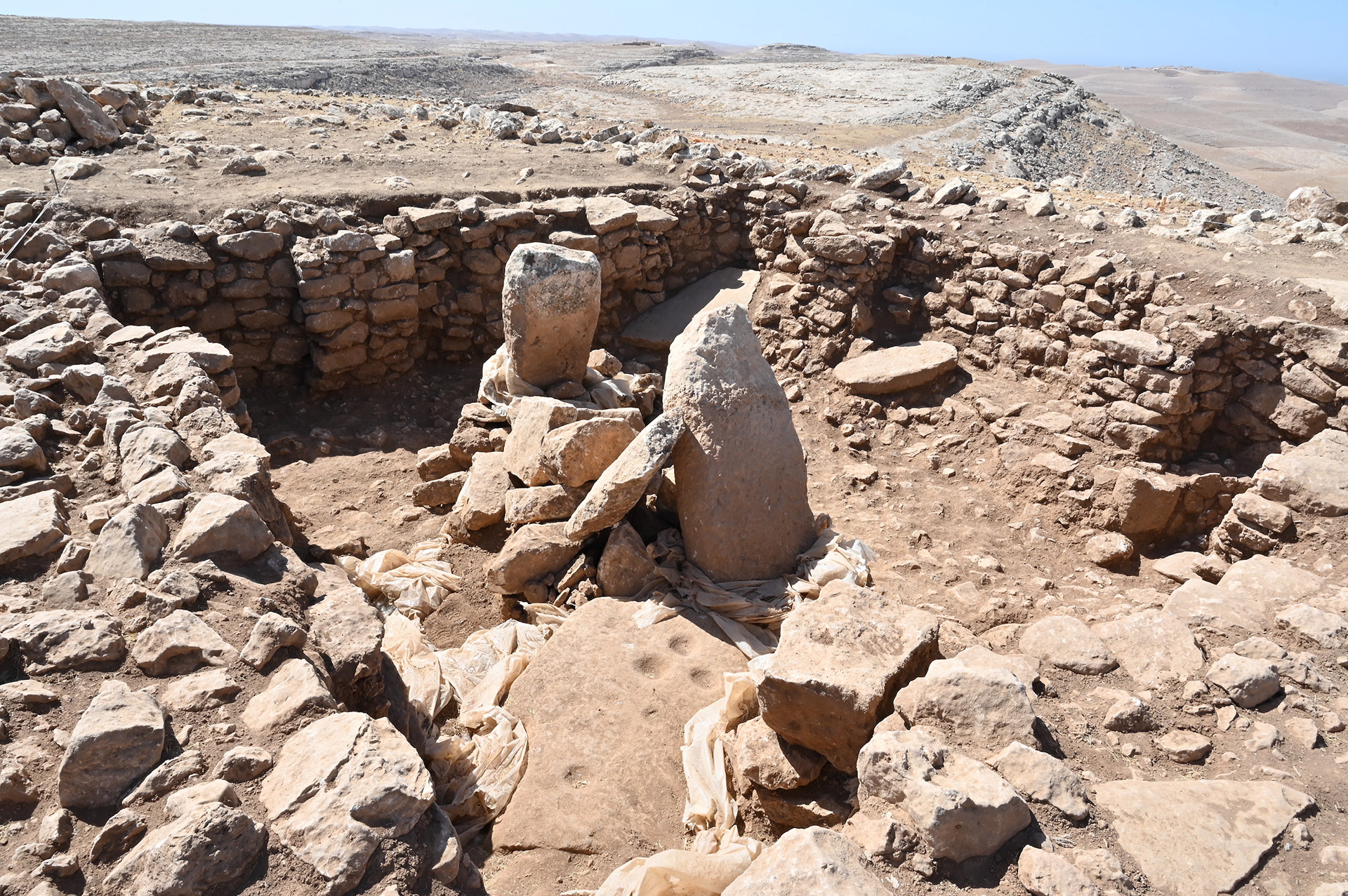
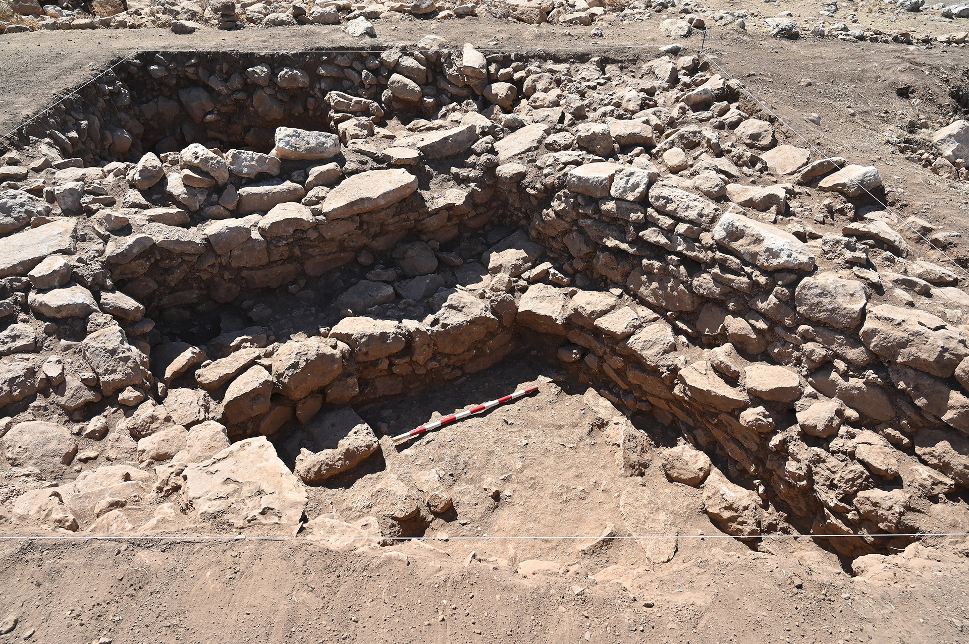
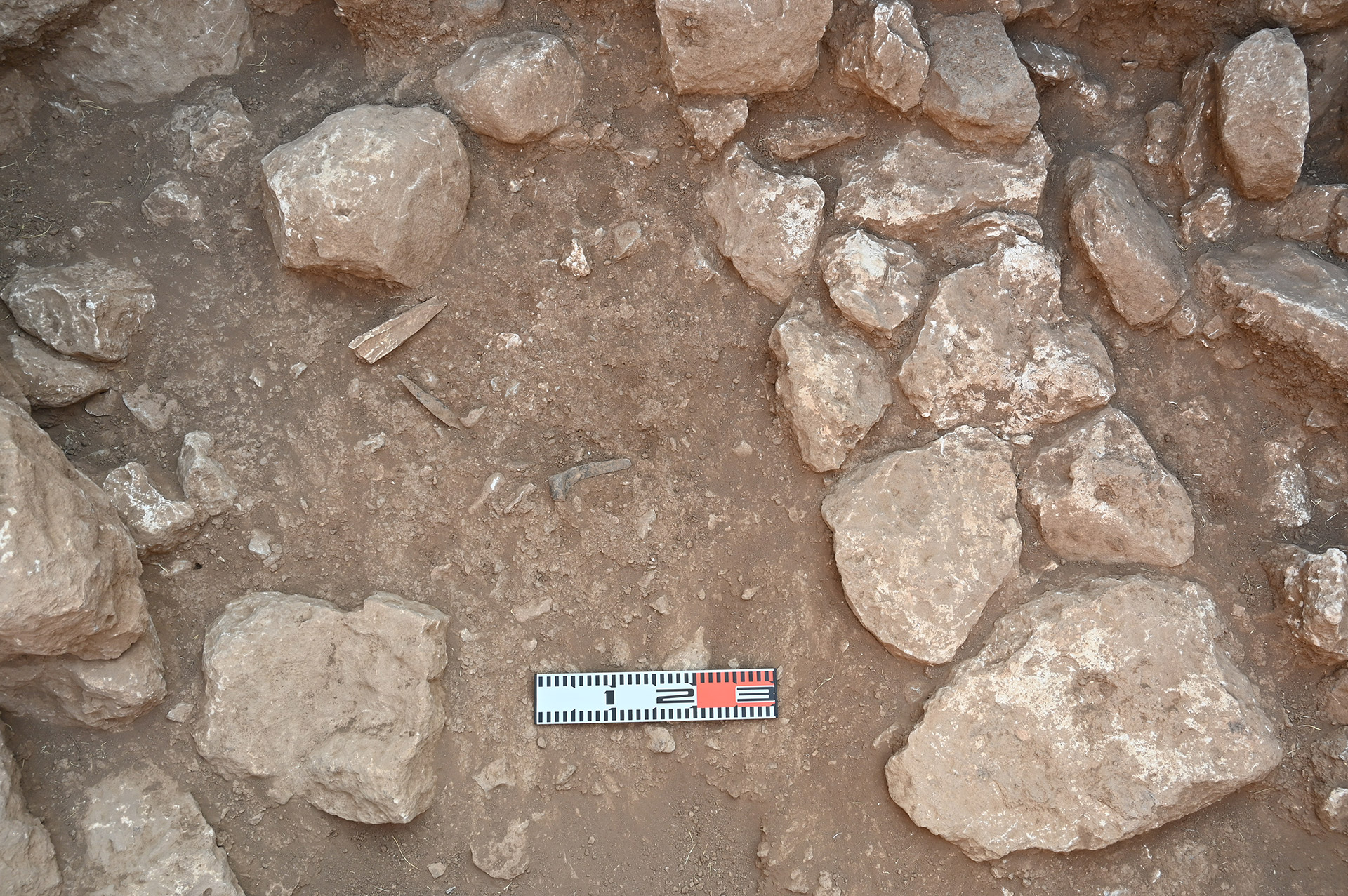
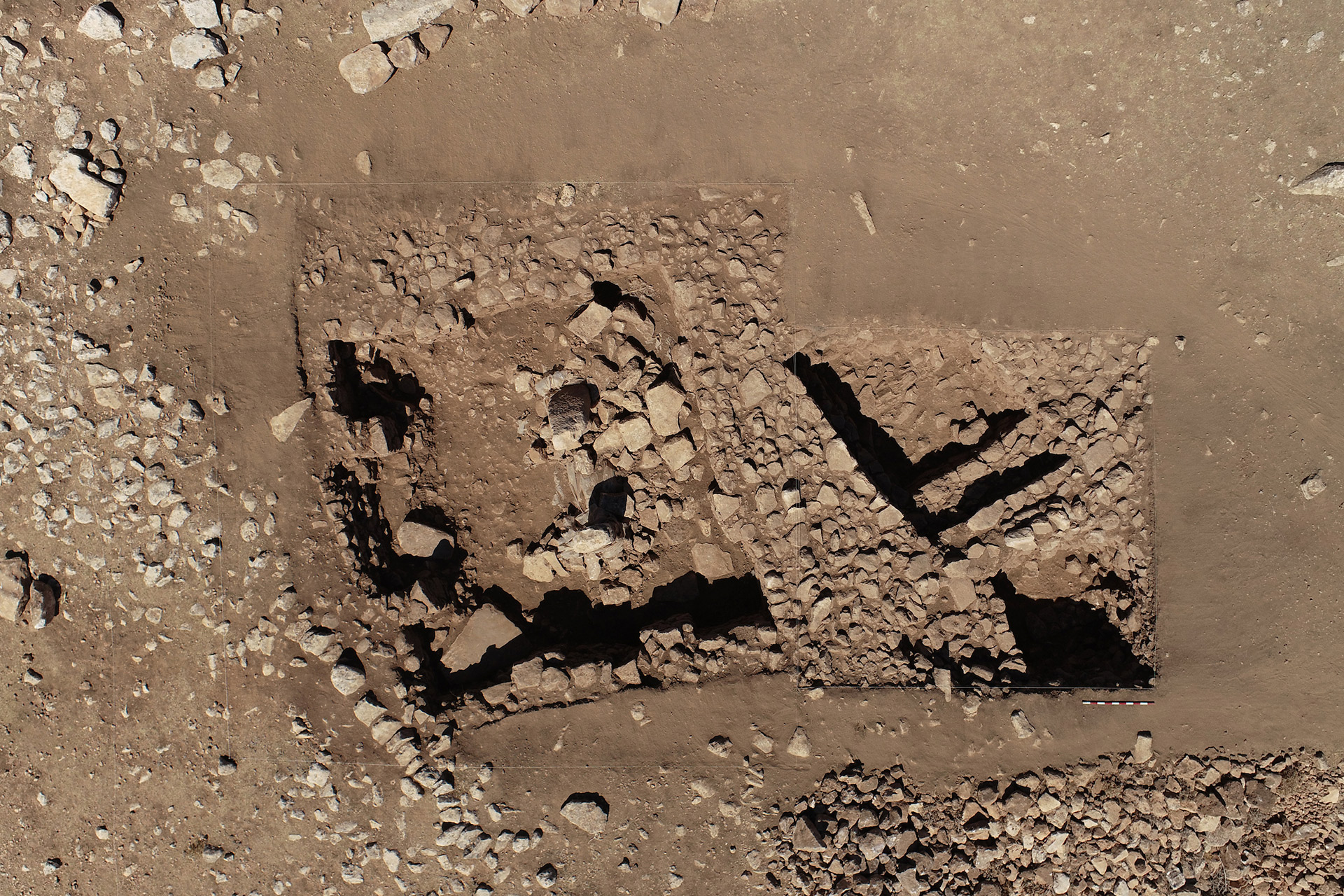
The resumed excavations have focused on cleaning the previous trenches to detail the archaeological contexts of the architectural structures, including the rectangular building, 5.3 m × 5.0 m, with a pair of stone pillars and elaborate interior buttresses on walls (Figs. 6, 7). Our stratigraphic examination indicates that although representing a single period (PPNB), the structures were subject to repeated modifications in the architectural layout (Fig. 8). The associated archaeological materials contained plenty of artifacts such as chipped stones, ground stones, bone tools, and personal ornaments (Fig. 9). Many were manufactured from non-local raw materials (obsidian, basalt, and jadeite), implying that they were procured or traded from some distance to the site. The non-artifactual assemblage included fragments of faunal remains. Interestingly, all these findings point to the domestic nature of the recovered buildings rather than a restricted purpose, such as cultic activities.
Our project includes an intensive surface survey at the mound and its immediate vicinity. The work in 2022 confirmed the abundance of flint artifacts on the surface, which convinced us of the origin of the site name (ruined mound of flint). At the same time, the lithic collection contained a small number of earlier periods than PPNB.

Fig. 10: Flint artifacts and animal bones discovered in situ in the lower layer..
Perspectives
Harbetsuvan Tepesi is a small mound site; however, the surface survey indicates that it is probably one of the localities of a larger site complex. Although the entire picture of its chronological position is yet to be determined, the main occupational period is most likely the early PPNB (Fig. 10). If this estimate is correct, it represents the EPPNB, a period just before the significant increase in domesticated food crops and animals in the northern Levant. Accordingly, Harbetsuvan provides an important opportunity to define the cultural and natural conditions in transition. The research agendas for cultural aspects may include the socioeconomic relationships of this small mound settlement with the surrounding mega cultic centers of Göbeklitepe and Karahantepe, and that between cultic and domestic activities in this period are issues among others to be further studied. In terms of the natural environment, precise reconstruction of palaeoenvironments during the EPPNB period would make a significant contribution to understanding the cultural change occurring in this period. The present project plans to deal with these issues among others to clarify the position of Harbetsuvan Tepesi in the Neolithization processes through an approach that combines archaeology and Geosciences.

Text: Kazuya Shimogama
Photos: Harbetsuvan Project Archive
We sincerely thank the Turkish Ministry of Culture and Tourism, General Directorate for Cultural Heritage and Museums, for their kind permission to conduct our project at Harbetsuvan Tepesi. Our particular thanks go to Dr. Sachihiro Omura, director of the Japanese Institute of Anatolian Archaeology at Kaman, Kırşehir, who has provided us with continuous help and advice to realize our project from the beginning. We are also very much indebted to many people and friends who contributed to and generously supported our work in various ways: Prof. Dr. Necmi Karul, Mr. Hasan Işıldak (vali of the Şanlıurfa Province), Eyyübiye Belediyesi, Mr. Aziz Ergin and Dr. Nezif Cıkay (representatives, Şanlıurfa Museum), Mr. Volkan Lordoğlu (Kültür Varlıklar ve Müzeler Genel Müdürlüğü, Şanlıurfa Kültür Varlıklarını Koruma Bölge Kurulu Müdürlüğü), Ms. Kiyoko Morota (Japanese Institute of Anatolian Archaeology), Dr. Makbule Beray Kösem (Ankara University), Ms. Dilara Nil Çolak (Hacettepe University), Dr. Nizar Polat and Mr. Yunus Kaya (Department of Geomatics Engineering of Harran University), students from Harran University), and workers from Karahisar village. Without their kind help, our fieldwork would not have been possible.
Republic of Türkiye Ministry of Culture and Tourism
Şanlıurfa Archaeology Museum
Chiba Institute of Technology
The University of Tokyo
Governorship of Şanlıurfa
Eyyubiye Municipality
Tastepeler Visit Information
Visit Information
Summer Period
1 April - 24 October
Working Hours: 08:30-19:00
Winter Period
24 October-1 April
Working Hours: 08:30-19:00
Box Office Summer/Winter Closing Hours
Summer Period: 18:30
Winter Period: 16:30
Closed Days: Open Every Day
Status: Open
Address
Şanlıurfa Archaeology Museum
Haleplibahçe, 2372. Sk. No:74/1,
63200 Eyyübiye/Şanlıurfa
Contact
Tel 1: +90 414 313 15 88
ktb-logo
Turkish Airlines is the main sponsor of Taş Tepeler.
ktb-logo
T.C. Culture And Tourism Ministry | All rights reserved.