

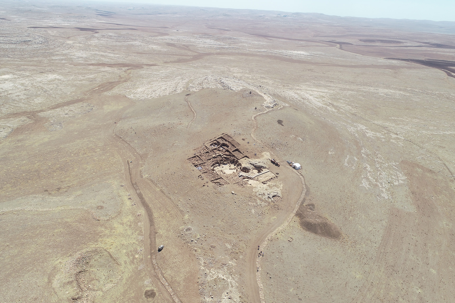
Location
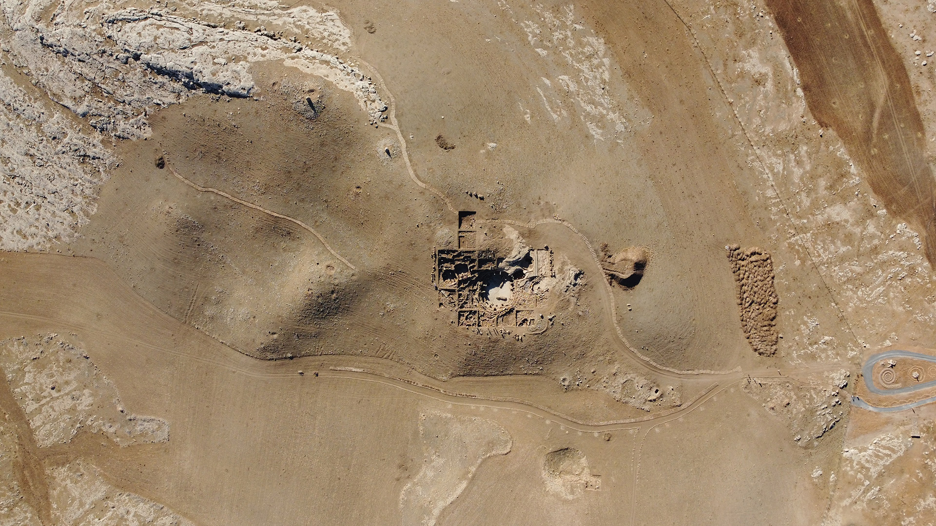
Karahantepe is located on one of the limestone heights within the Tek Tek Mountains National Park, 55 km from downtown Şanlıurfa. The Tek Tek Mountains are a 60 km long flat plateau between the Harran and Viranşehir plains, the highest part of which is 761 meters above sea level in the north and drops below 500 meters in the south. The limestone heights in the form of slabs provide both the building material and the raw material for the construction of the T-shaped pillars at Karahantepe and other contemporary sites. Surface scans and geomagnetic measurements indicate four distinct sections at Karahantepe. The first is the western and eastern terraces, where the tops of the T-shaped pillars are visible on the surface, and even rounded structures of different sizes defined by the arrangement of these stones can be distinguished. The section where there are no pillar-like remains on the surface and where residential building-related artifacts such as grinding stones are concentrated is called the Southern Plain. The section where T-shaped pillars were quarried on the terraces of the western cone descending to the south and west is called the “Quarries”. Although the predictions regarding the division of Karahantepe are mainly based on the archaeological data obtained from the surface, the existing topography and the morphological characteristics of the bedrock also confirm this division.
Research History
Karahantepe is one of the Neolithic settlements being studied within the framework of the Şanlıurfa Neolithic Research Project – Taş Tepeler, which is a continuation of the Southeastern Anatolia Joint Project. Karahantepe, located in the Tek Tek Mountains National Park, was discovered in 1997. Research at the site has been carried out by an international team on behalf of the Istanbul University Department of Prehistoric Archaeology since 2019.


Archaeological Research
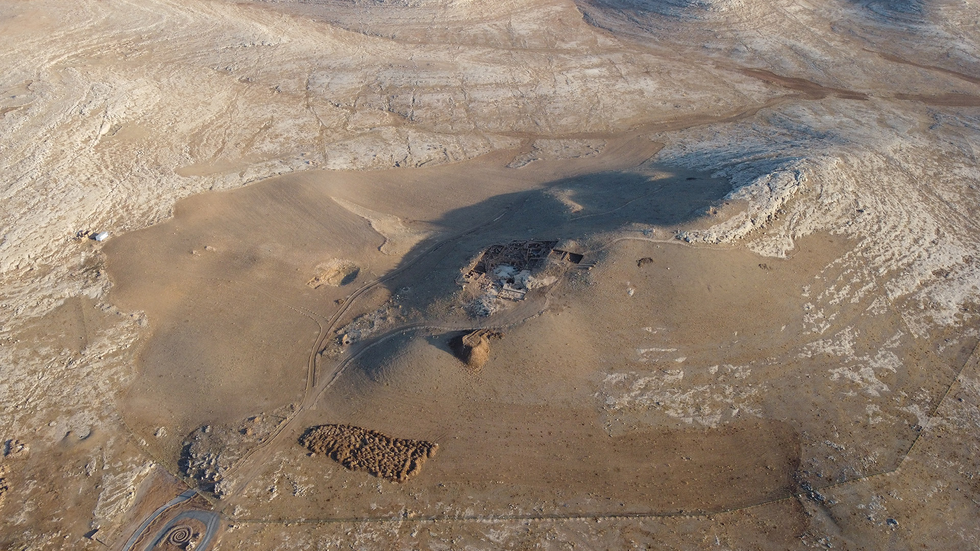
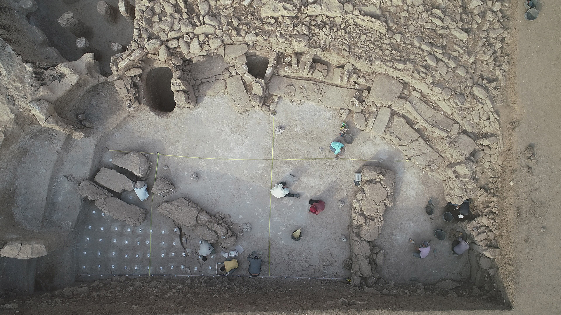
The archaeological excavations at Karahantepe have been carried out on the western slope since 2019. Due to the sloping topography of the area, bedrock surfaces can be seen in the upper parts of the site, while steps with sharp drops are formed towards the north. Where these steps are located, there are structures carved into the bedrock. Excavations to date have revealed a settlement with three phases.
Aims of the Project
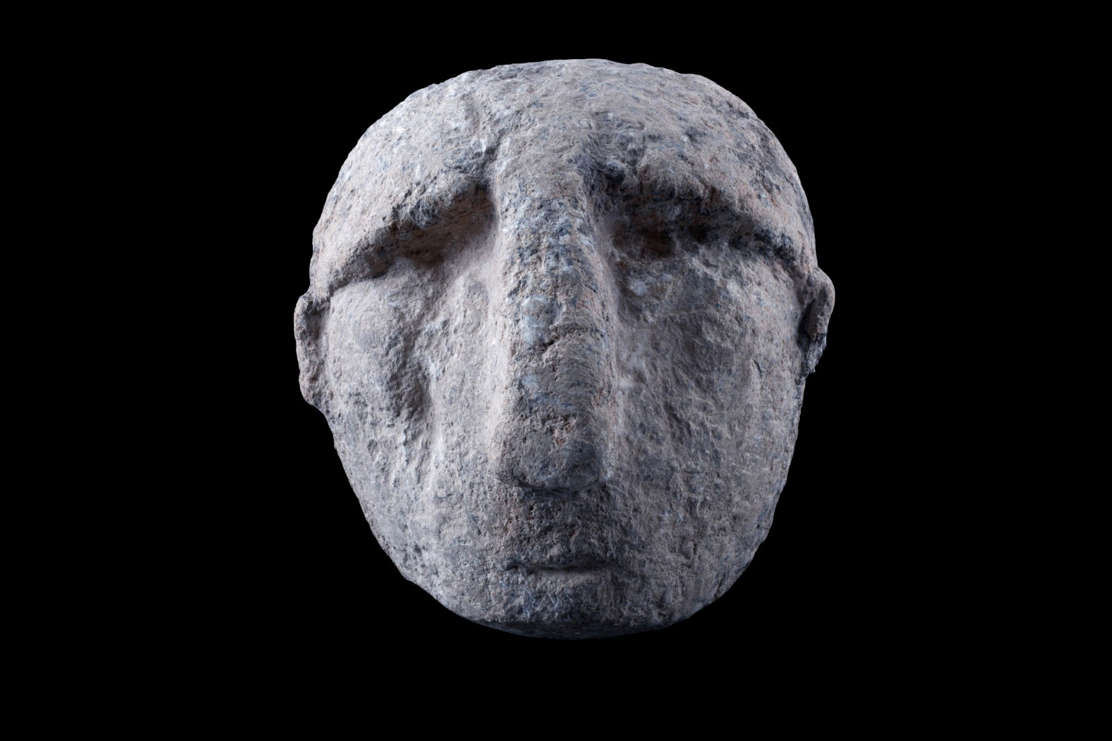
It is known that at the beginning of the Neolithic period, around the middle of the 10th millennium B.C., many settlements appeared around Şanlıurfa, as in the entire Southwest Asia, and that a dense population began to live together nearby and in relatively crowded groups. The early Neolithic communities in the Şanlıurfa plateau clearly constitute a unique cultural integrity, especially with their large-scale settlements, monumental structures with strong symbolic aspects, and three-dimensional sculptures.The main aims of the Karahantepe Research Project are addressed below:

To collaborate on detailed evaluations of the use of special buildings, sculptures and reliefs, and symbolic elements,
To understand the role of special structures and depictions in the construction of new social life during the transition to sedentarization, a period of radical transformations in the way of life,,
To understand how and for what purpose the spaces were used by carrying out detailed studies, especially in residential buildings,
To describe the process of mounding and settlement in a settlement built on a large area and a dynamic topography,
To understand the architectural and technological transformations of the settlement over a long period of time,
To collect data to show how the process of domestication and transition to agriculture took place,
To do surveys around the settlement to determine how the area was used (quarries, water sources, hunting grounds, ateliers, etc.).

Communal Buildings
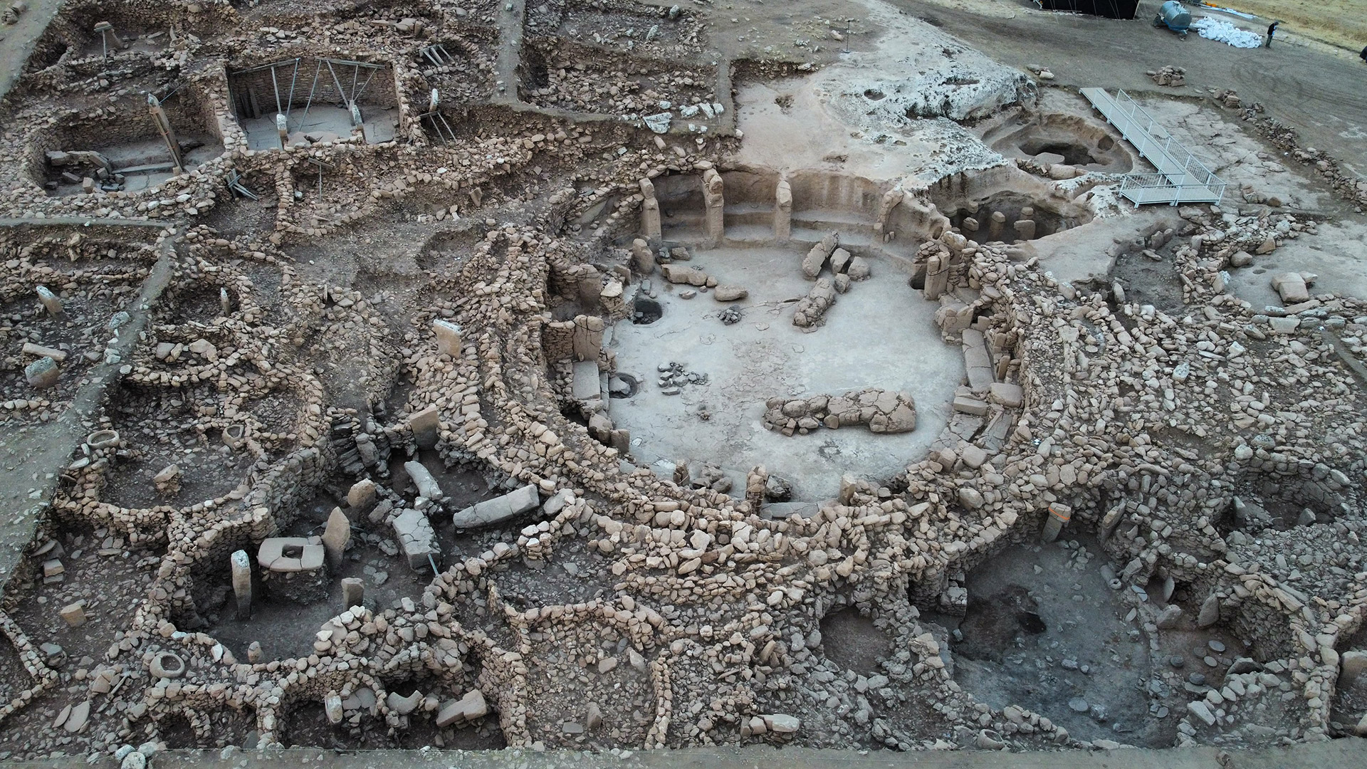
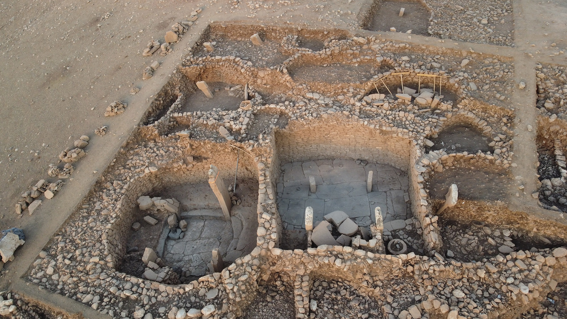
On the lower levels of the western slope, a complex of circular communal buildings was excavated. Although the complex, which was probably designed and built together, is currently defined by three buildings, there are other communal buildings associated with the group. Structure AD in the center of the complex has an internal diameter of 23 meters. One side of the structure was formed by cutting the bedrock by 4.5 meters and the rest of the structure is surrounded by stone walls. The walls indicate at least three phases built one inside the other. The floor of the building was obtained by leveling the bedrock. The wall of the building is divided by 16 pillars and there are two-step benches between the pillars. In the center of the building, two more pillars are facing each other. At the bottom of the building, there are deep pits dug into the ground in two different places. There are also pits dug into the rock in front of the benches and then covered over.

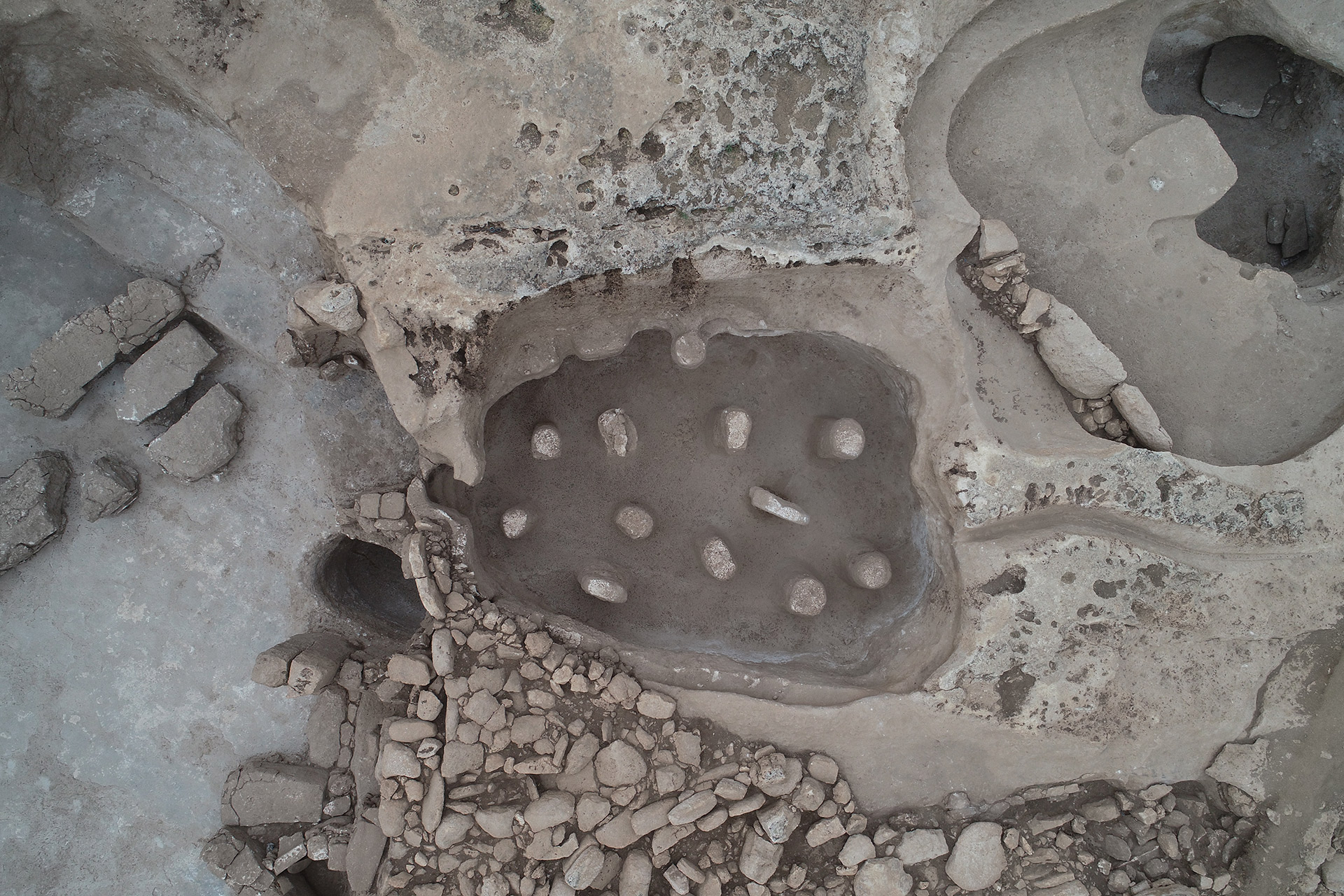
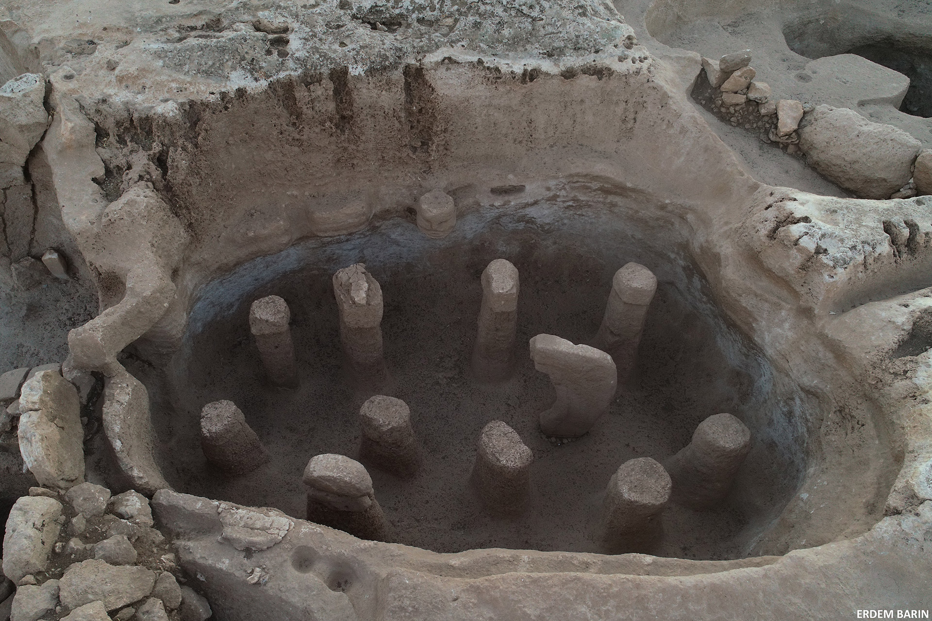
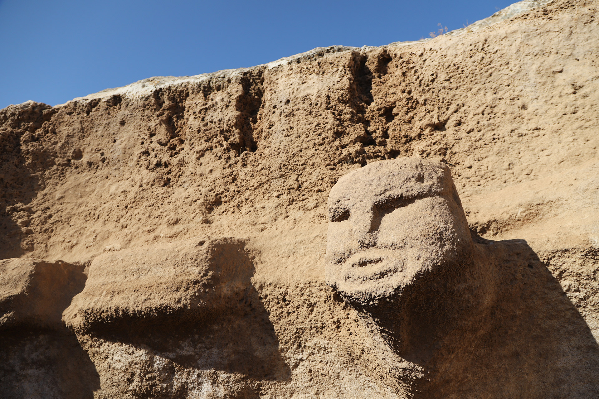
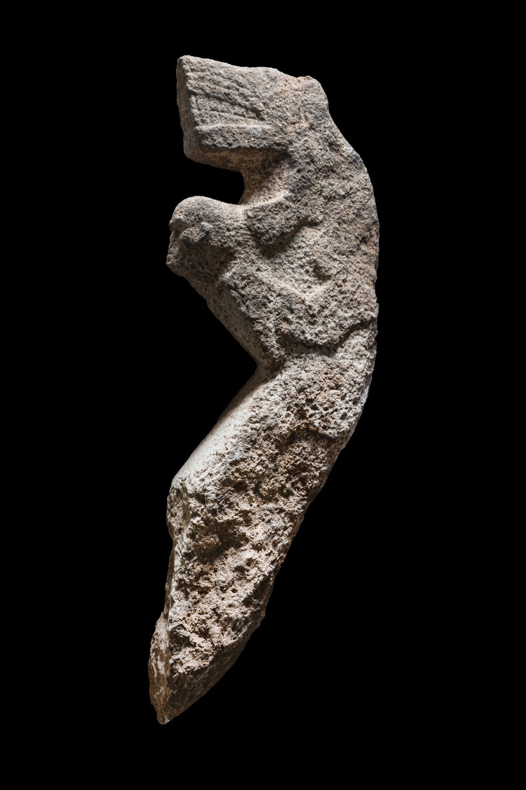
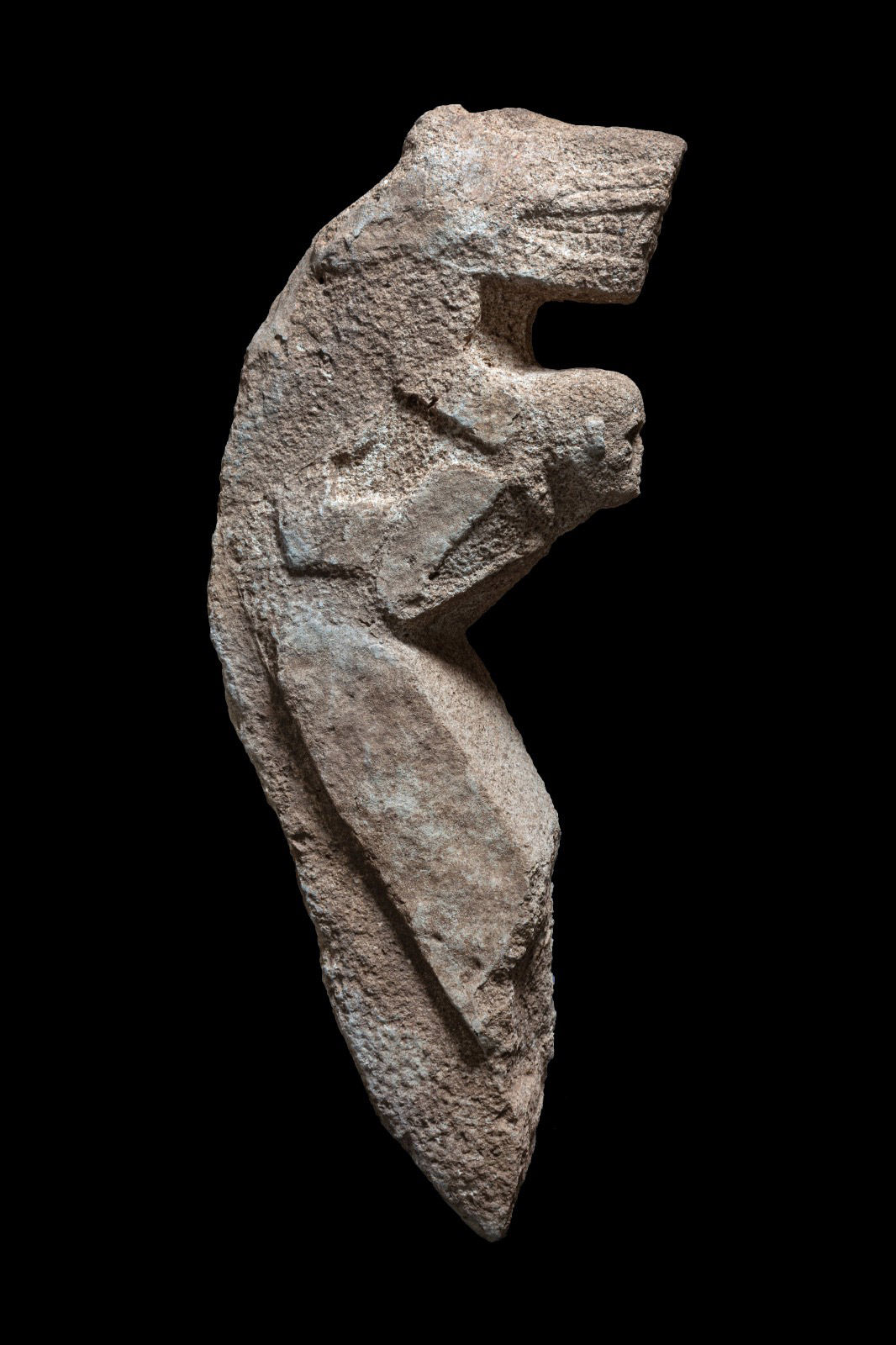
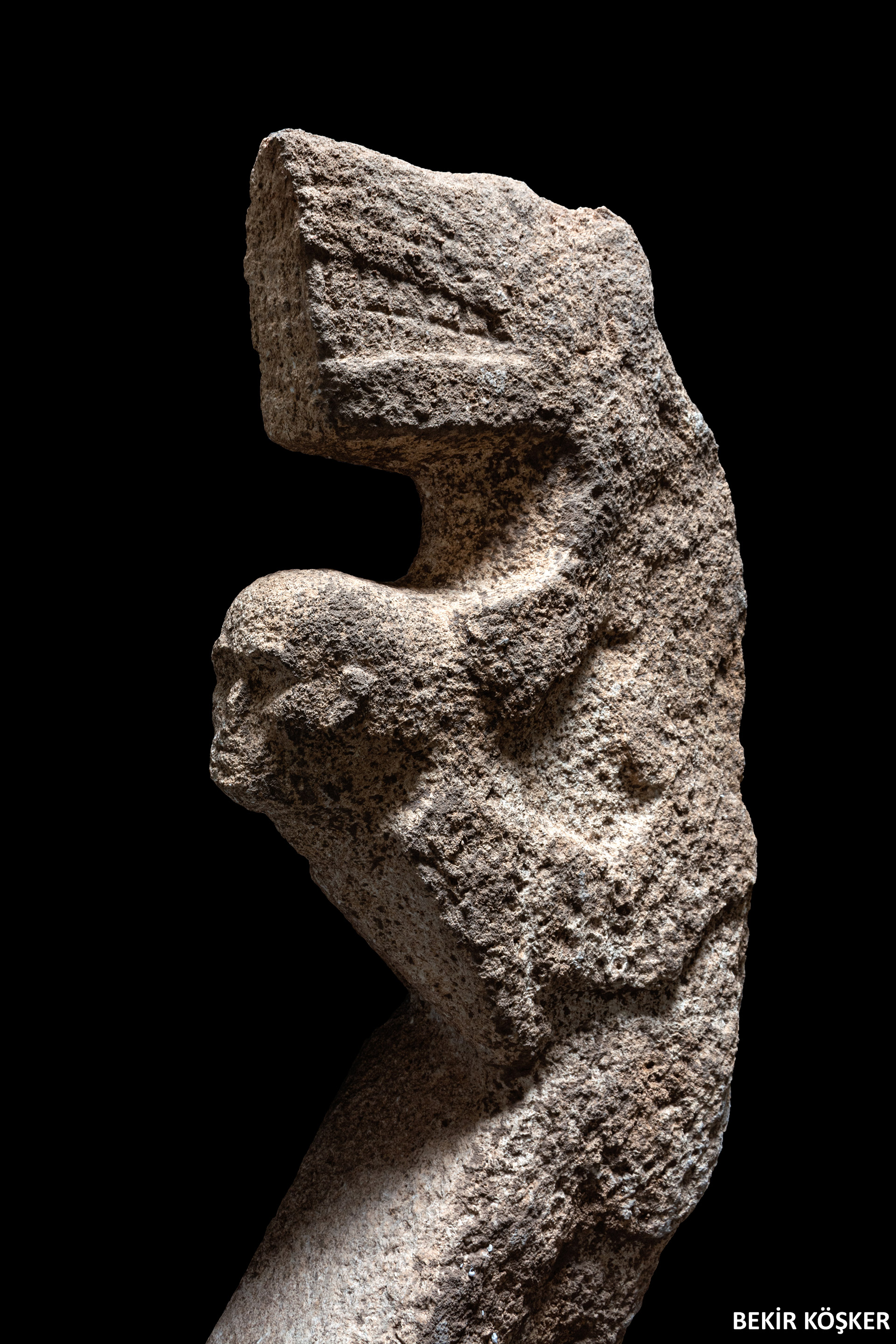
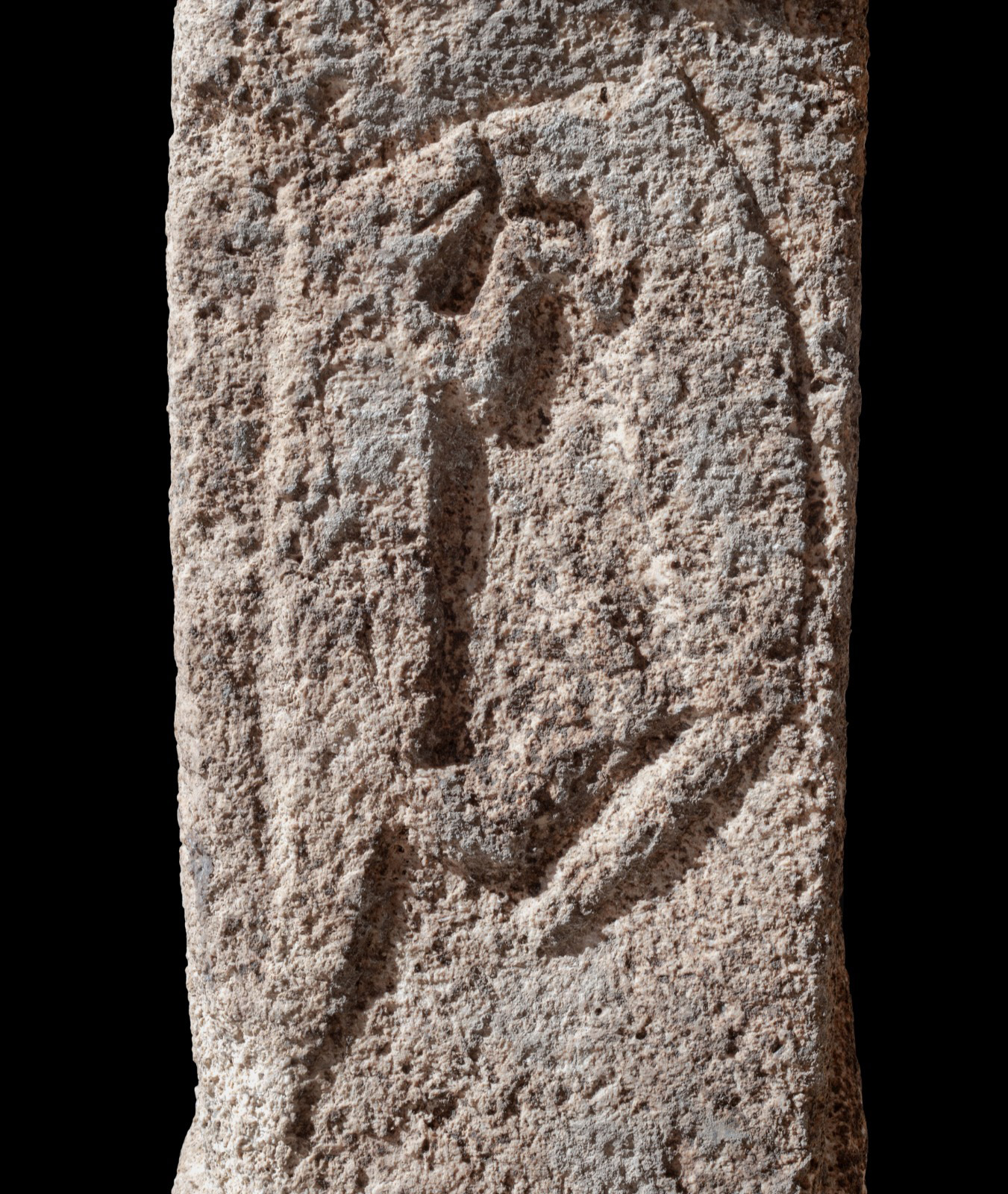
Structure AB, adjacent to Structure AD, is also dug into the bedrock. Measuring 7x6 meters and 3.5 meters deep, it is connected to Structure AD by a staircase. At the other end of the structure is a second staircase, which was probably used for exiting. On the long wall, there is a human head carved into the bedrock, and opposite it are 10 pillars left in place during the construction of the structure, and these pillars have the appearance of phalluses. To the north, a serpentine-shaped channel carved into the surface runs obliquely into the structure, suggesting a ritual involving liquid. In fact, a small opening at the junction of the AD and AB structures allows liquid to be poured into the pit of the AD structure. Ethnographic examples demonstrate the importance of rites of passage in the process of individual incorporation into society. The location and structural features of Structure AB within the complex suggest a similar situation, and it is interpreted as a structure related to puberty/transition rituals.

Dwellings
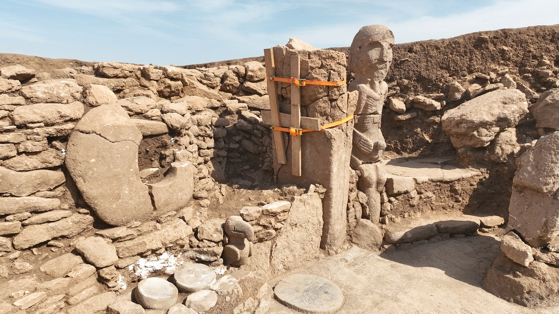
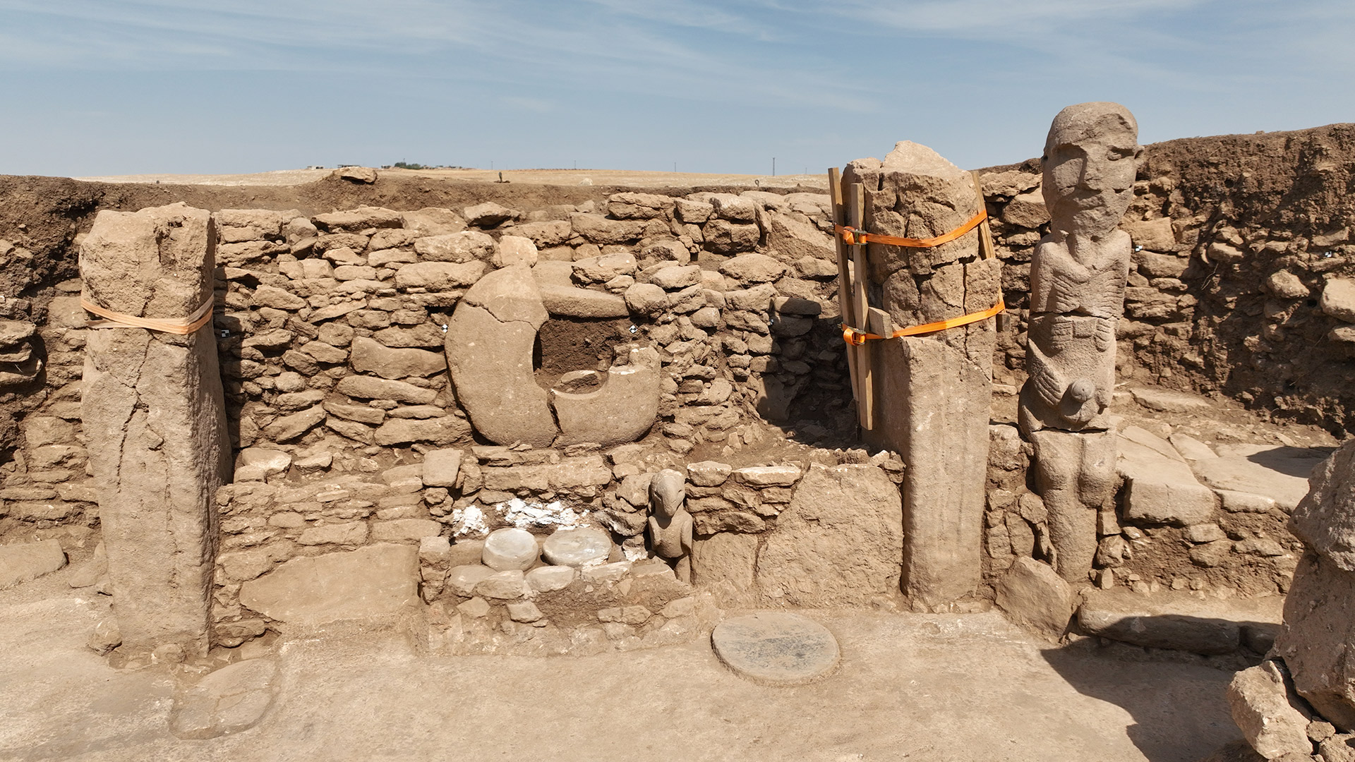
A large number of buildings surrounding the east and south of the communal building complex have the appearance of a dwelling with their construction techniques and dimensions. It isn’t possible to speak of a standardized size and plan in these structures, which were built in accordance with the slopes of the topography and added to each other. It is noteworthy that there are small pillars inside the buildings. Except for the pillars, all finds inside the buildings are domestic in nature. Stone troughs, groundstones, mortars, pestles, and handstones are the main finds.

Communal Buildings with Quadrangle Plans
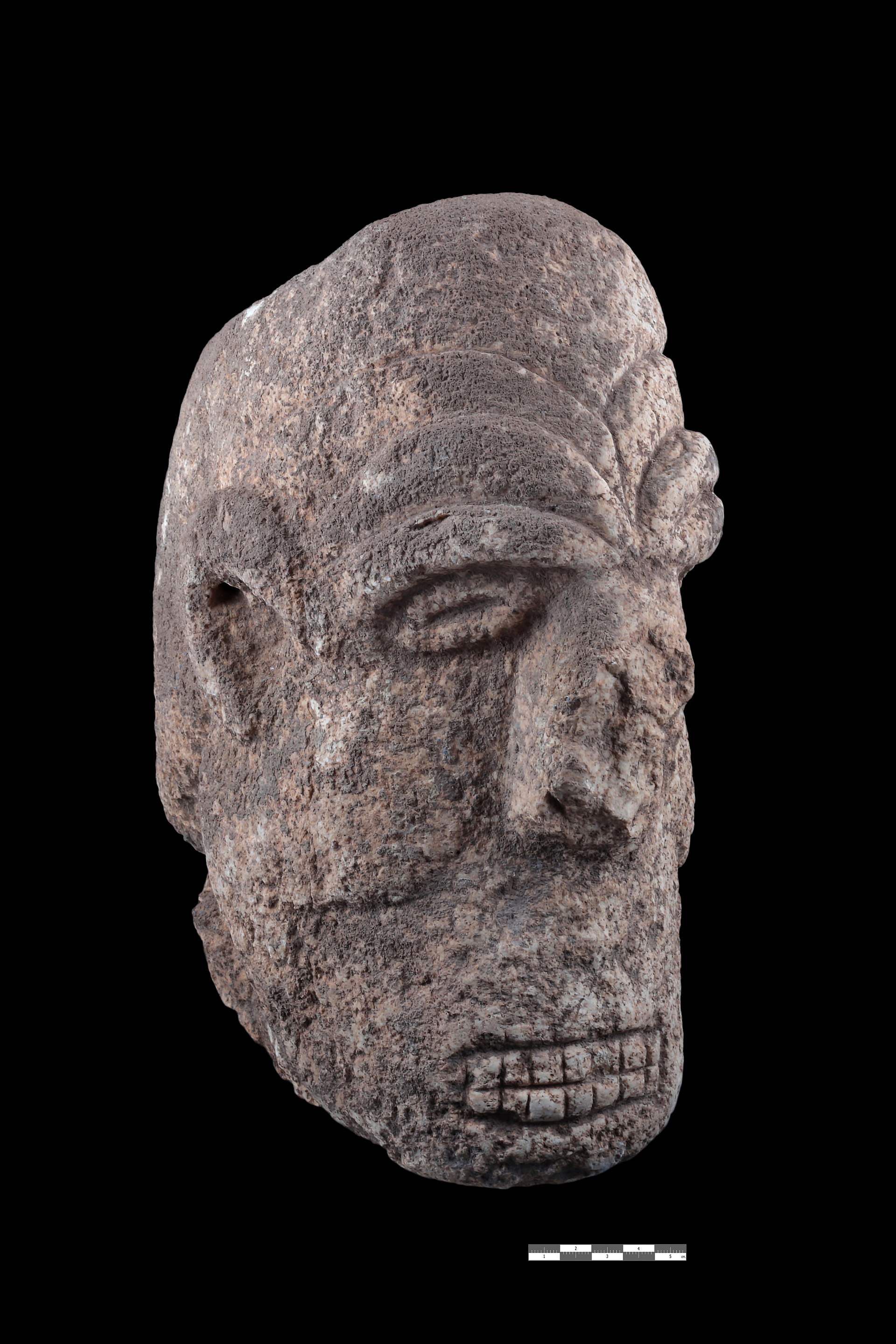
Communal buildings with quadrangle plans on the western slope were built following the slope of the land, adjacent to each other and forming terraces. The fact that these buildings are adjacent to, but not on top of, the circular monumental buildings of the previous phase suggests that they were built with the knowledge of the existence of the previous ones. Again, some of these buildings have meticulously constructed walls and the preserved wall height of some of them is up to 4 meters. The practice of two-step benches continues along the wall. T-shaped pillars placed symmetrically inside the buildings are standard. The pillars are decorated and some of them have arm and hand reliefs on them. There are also carefully arranged areas within the space. In these areas, there are cylindrical stone slabs on the floor, niches, and stone vessels placed in the walls. The floors of the buildings are covered with terrazzo or large stone slabs that are overlapped. It is understood that the quadrangular communal buildings were deliberately filled in after their function was completed Text: Necmi Karul, Photos: Karahantepe Project Archive, Bekir Köşker ve Yusuf Aslan
Republic of Türkiye Ministry of Culture and Tourism
Istanbul University
Turkish Historical Society
Governorship of Şanlıurfa
Sub-Governorship of Haliliye
Şanlıurfa Municipality
Haliliye Municipality
Society for Supporting Karahantepe Research
Mastership Agency
Komili Türkiye
Ömür Akkor Foundation
