ÇAKMAKTEPE
Chasing gazelles
ÇAKMAKTEPE
Location
Çakmaktepe is located about 20 km southwest of downtown Şanlıurfa, within the borders of Herim/Ödüllü village, Koçören neighborhood, Eyyübiye district. It is a hilltop settlement located on the Eocene limestone plateau called the Fatik (Cudi) Mountains at an altitude of about 670 m above sea level (Pic. 2-3). The settlement is about 150 m in diameter. However, apart from the usual settlement patterns, there are also buildings around the main settlement and it is spread over a larger area.

In the vicinity of Çakmaktepe, there are many settlements dating back to the Pre-Pottery Neolithic, some of which have been identified in previous studies and some of which have been identified during the surveys under ŞAYA (Şanlıurfa Archaeological Survey), and they are about 2-3 km away from each other. Çakmaktepe is located on the same line with Bademli, Sayburç, Yoğunburç and Ayanlar in the north and Borbore, Mendik, Gotik Tepesi and Nergislik in the south. The region where Çakmaktepe and dense settlements of Pre-Neolithic are located seems to be an important place in the transition of hunter-gatherer nomadic communities to settling with its favorable climatic and environmental conditions.
Research History
Çakmaktepe was discovered in the first year of the Şanlıurfa Archaeological Survey (ŞAYA) Project started in 2021 in the western part of the Harran Plain (Pic. 1). Çakmaktepe was discovered as a result of satellite imagery analysis and later that year, joint excavations were initiated with Çukurova University and Şanlıurfa Archaeological Museum as part of the Şanlıurfa Neolithic Research Project – Taş Tepeler. The University of Tsukuba, Japan has also been involved in the excavations since 2022.
Cakmaktepe-4
Cakmaktepe-7
Cakmaktepe-8
Cakmaktepe-9
Cakmaktepe-10
Cakmaktepe-13
Cakmaktepe-14
Cakmaktepe-1
Cakmaktepe-2
Cakmaktepe-3
Cakmaktepe-4Cakmaktepe-7Cakmaktepe-8Cakmaktepe-9Cakmaktepe-10Cakmaktepe-13Cakmaktepe-14Cakmaktepe-1Cakmaktepe-2Cakmaktepe-3
v 4
Archaeological Research

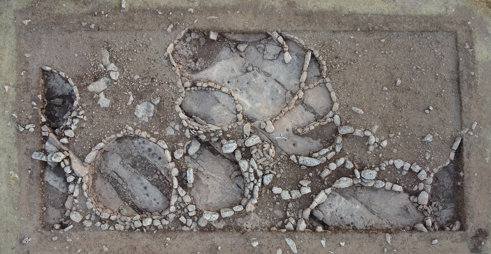
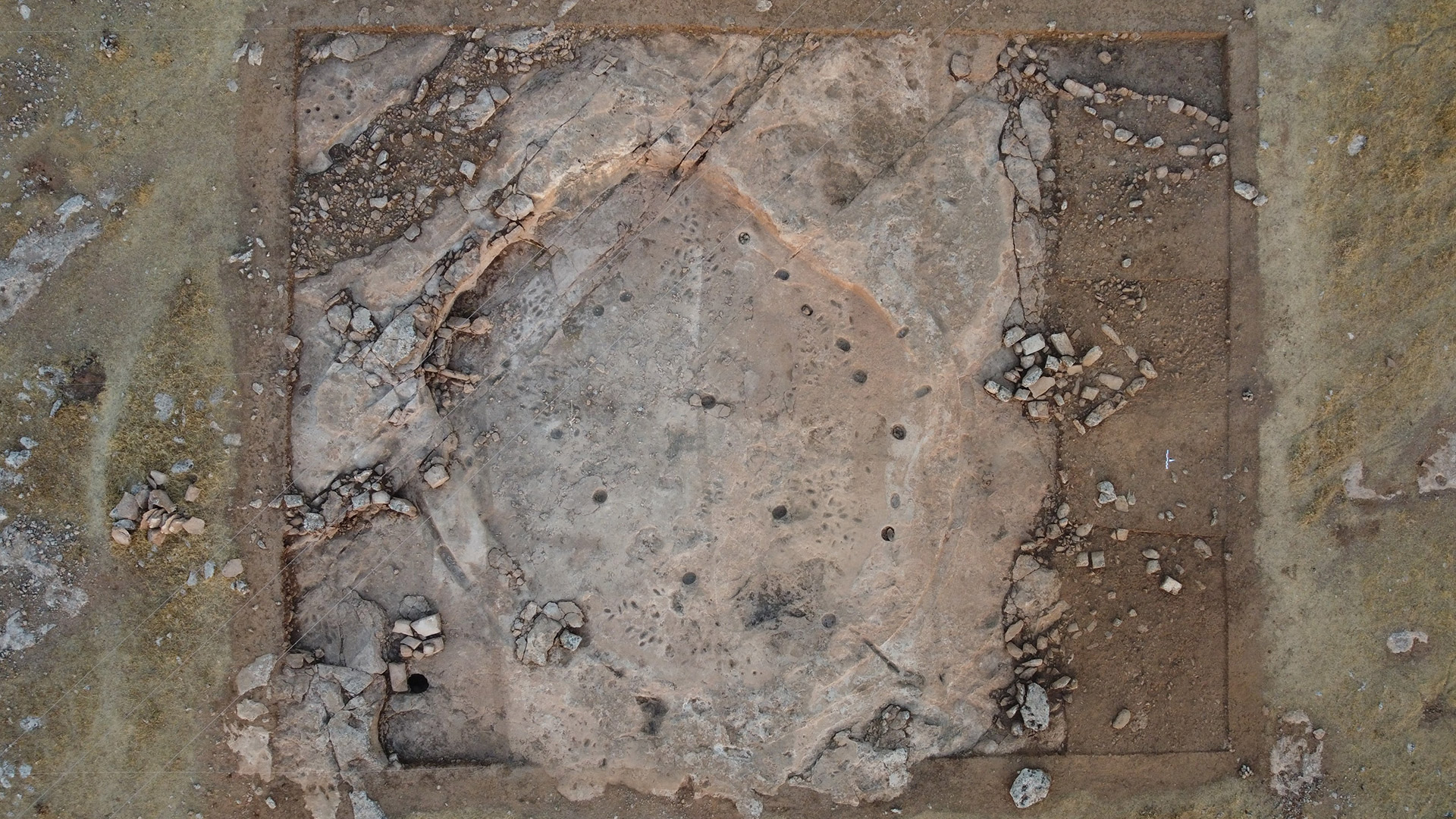
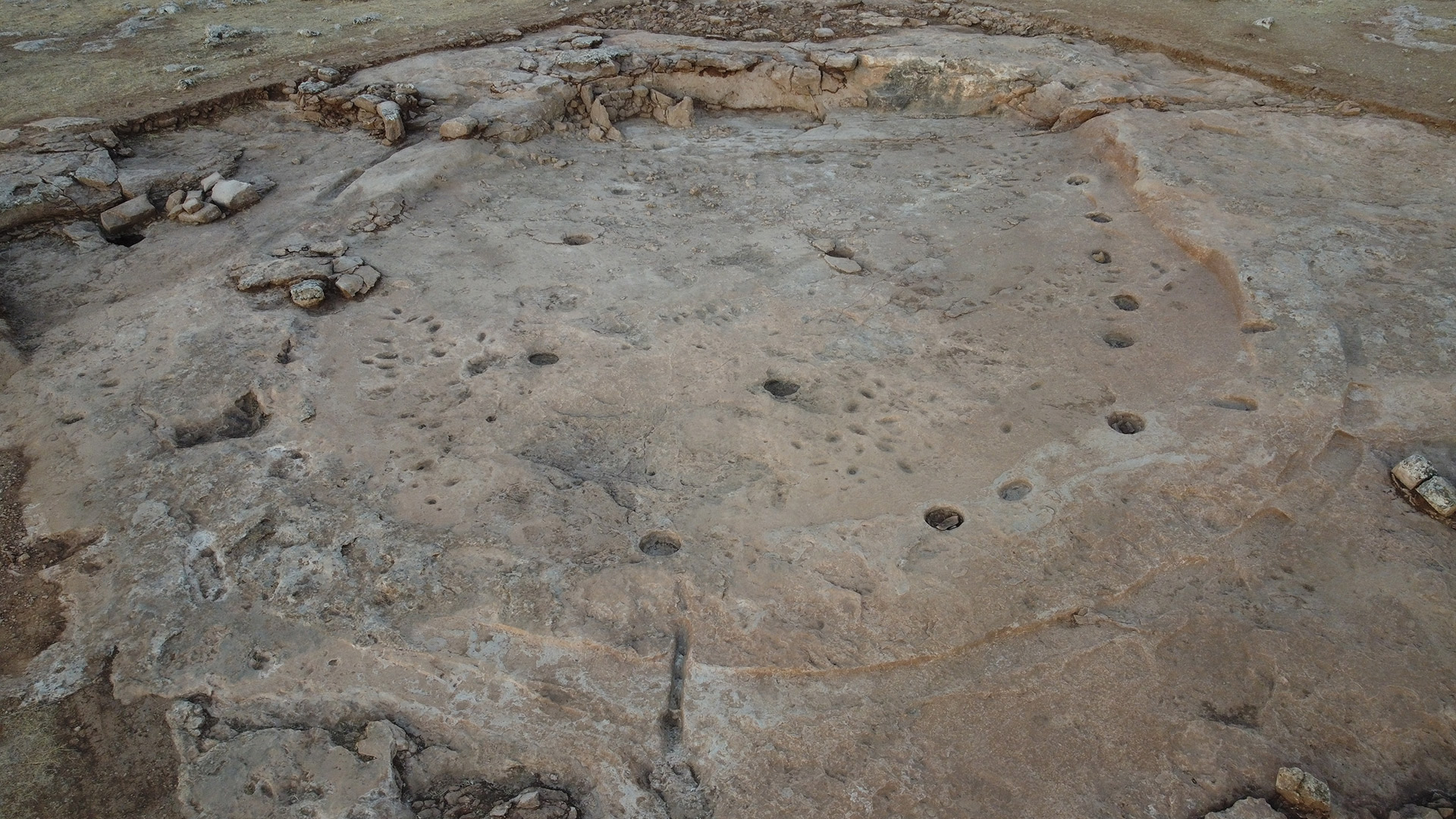
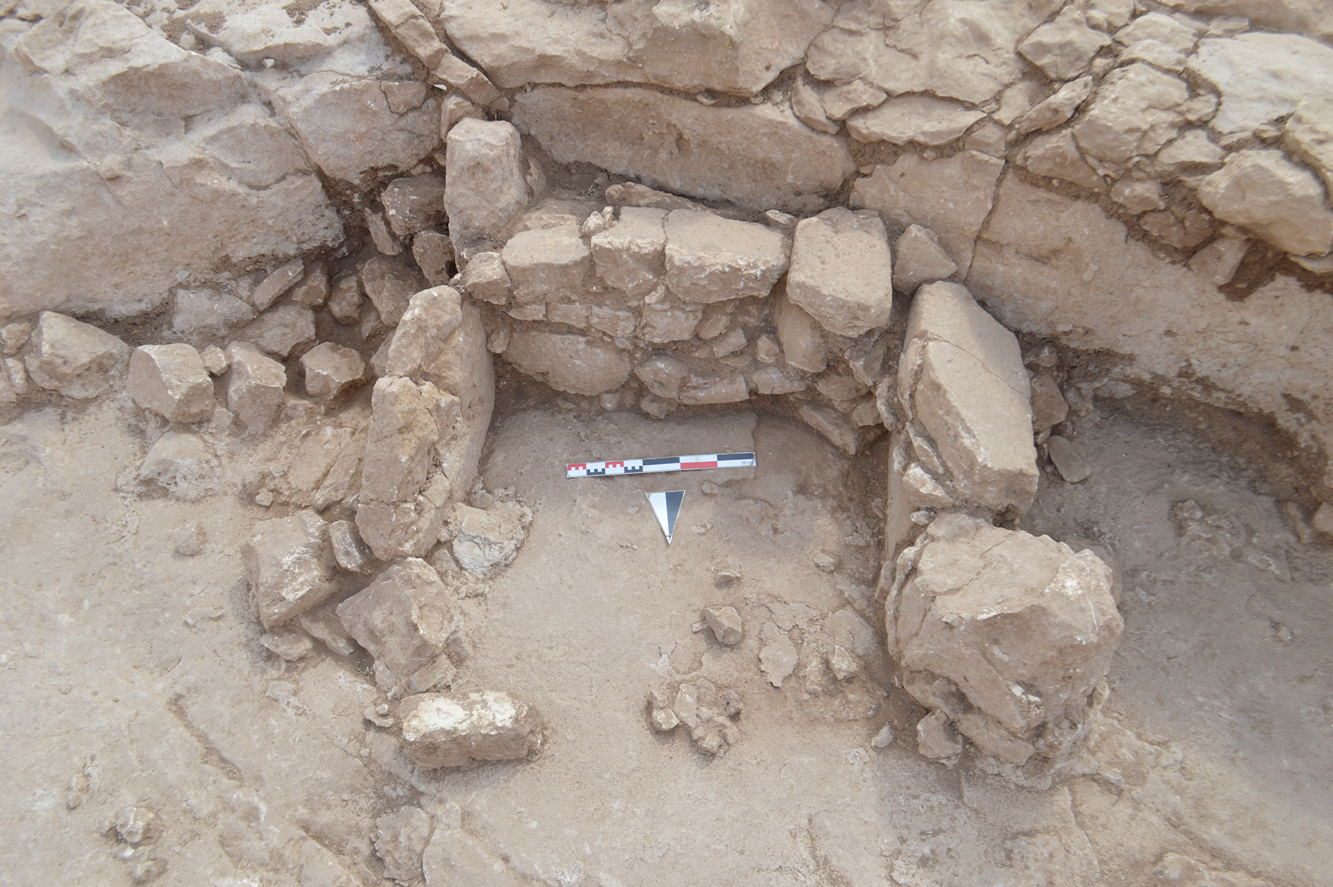
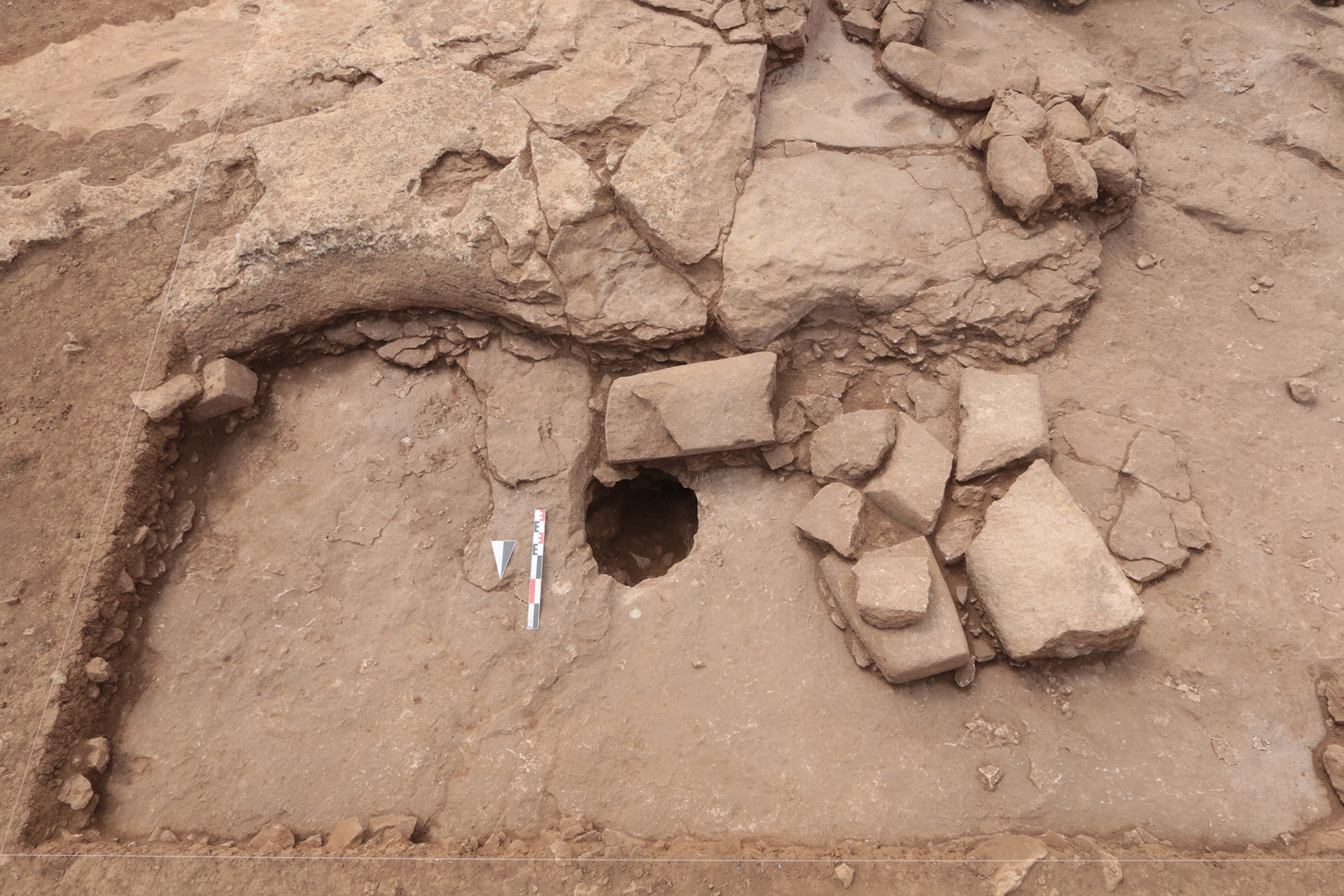
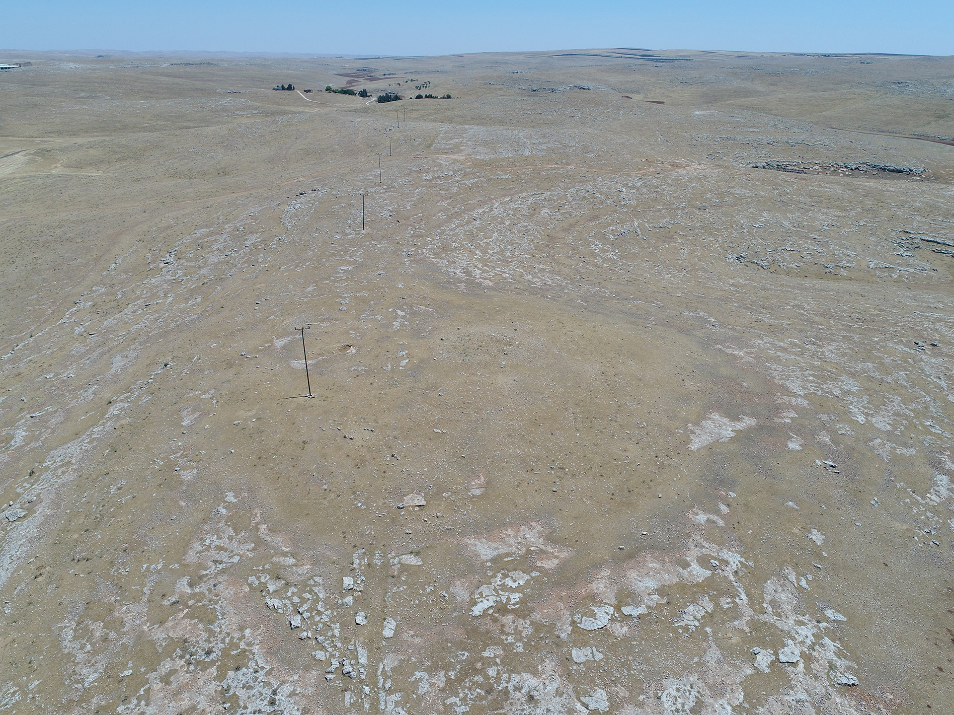
The bedrock was used as the floors of the dwellings with diameters ranging from 3-5 m (Pic. 4-5). In areas where the bedrock is sloping, the first attempts at terrazzo flooring were made by laying gravel floors. .

Fig. 5
Inside the buildings, conical holes of various sizes and depths are carved into the bedrock (Pic. 5). Such pits, which are more common in Natufian settlements in the Levant, are considered mortars and are important for understanding the transition from hunting and gathering to food production, one of the greatest innovations in human history. The density of subterranean dwellings indicates that the settlement was densely populated and therefore the environmental conditions were quite suitable for life.
One of the special/communal buildings at Çakmaktepe was fully unearthed (Pic. 6). It is a circular building with a diameter of about 16 m, built by carving the floor into the bedrock in correlation with the topography of the site. The fact that no other remains, such as a partition wall, were found except for the area considered to be a bench and the post holes in the floor, indicates that this building was constructed as a single-room building. However, an exception was found in the southern part of the building, next to the bench wall, where a quadrangular building element with one open side was found. This remains was left open towards the interior of the building and measures approximately 1.5x1.5 meters (Pic. 7). It appears that this special/communal building was intentionally filled in a short period of time rather than by a natural process. The presence of neatly placed rows of stones in some places among the fill stones indicates that this building was not filled randomly, but was carefully backfilled in a more controlled manner. Fragments of well-worked pillars were also unearthed in the immediate vicinity of the building (Pic. 8). In another partially unearthed special/communal building, skulls of wild cattle, sheep, and equids were found deliberately placed at the foot of the walls inside the building after having been burned outside (Pic. 9). Such practices suggest that these buildings may have been used for ritual purposes. The presence of special/communal buildings carved into the bedrock, with diameters approaching 16 m, shows that hunter-gatherer communities, even in the early stages of the transition to sedentary life, not only sought food but also brought communities together by emphasizing social connections and communal life.
Fig. 10

The small finds from Çakmaktepe include stone vessels and ornaments such as stone beads.

The groundstones and grinding slabs unearthed during the excavations indicate that wild plants were collected and ground during this period.

Preliminary identification of animal bones unearthed during the excavations indicates the presence of wild species such as cattle, horses, pigs, gazelles, and rabbits. It is assumed that at least some of these animals were attained from the animal traps/hunting grounds found around the settlements during the surveys done in the region. These hunting grounds, which indicate expert hunting where animals were controlled in an organized manner, must have played an important role in the nutrition of the communities during this period and the transition to settlement. In addition, an artifact with an antelope hunting scene was found at Çakmaktepe, which shows the importance of hunting (Pic. 10).

Fig. 11
The chipped stone material from Çakmaktepe includes stone bruins, perforators, blades and points (Pic. 11). On the basis of the chipped stone material and the points, which are mostly known from the Levant and are called El-Khiam in the archaeological literature, the settlement of Çakmaktepe is dated to the beginning of the Pre-Pottery Neolithic (PPNA) (10000-9500 B.C.).

<>The Çakmaktepe settlement reflects an earlier stage of the settlement process compared to other Pre-Pottery Neolithic settlements in the region such as Göbeklitepe, Karahantepe, Harbetsuvan, Sefertepe and Sayburç. Çakmaktepe is one of the oldest sedentary hunter-gatherer settlements in Anatolia that has been identified and excavated. The data obtained from Çakmaktepe reflect a certain organization, knowledge, and experience as well as superior skills in such an early period of settlement.

Text: Fatma Şahin, Yutaka Miyake
Photos: Çakmaktepe Project Archive
Aims of the Research
The main aims of the Çakmaktepe research which is international and carried out by many teams of experts within the scope of the Şanlıurfa Neolithic Research Project are addressed below:
To understand how this period began, developed, and shaped Çakmaktepe, which reflects the early stages of the settlement process compared to other Pre-Pottery Neolithic settlements in the region,
To do studies in order to understand the density and distribution of residential buildings in the settlement, as well as daily life activities and thus population density,,
To understand how the special/communal buildings, which have brought communities together, were positioned, their functions, usage processes, reasons for burial, and their place in social life,
To identify the wild fauna and flora species in the settlement and to clarify the role of these species in settlement selection and their contribution to domestication processes
Republic of Türkiye Ministry of Culture and Tourism
Çukurova University
Tsukuba University
Şanlıurfa Archaeology Museum
Turkish Historical Society
Governorship of Şanlıurfa
Sub-Governorship of Eyyubiye
Tastepeler Visit Information
Visit Information
Summer Period
1 April - 24 October
Working Hours: 08:30-19:00
Winter Period
24 October-1 April
Working Hours: 08:30-19:00
Box Office Summer/Winter Closing Hours
Summer Period: 18:30
Winter Period: 16:30
Closed Days: Open Every Day
Status: Open
Address
Şanlıurfa Archaeology Museum
Haleplibahçe, 2372. Sk. No:74/1,
63200 Eyyübiye/Şanlıurfa
Contact
Tel 1: +90 414 313 15 88
ktb-logo
Turkish Airlines is the main sponsor of Taş Tepeler.
ktb-logo
T.C. Culture And Tourism Ministry | All rights reserved.